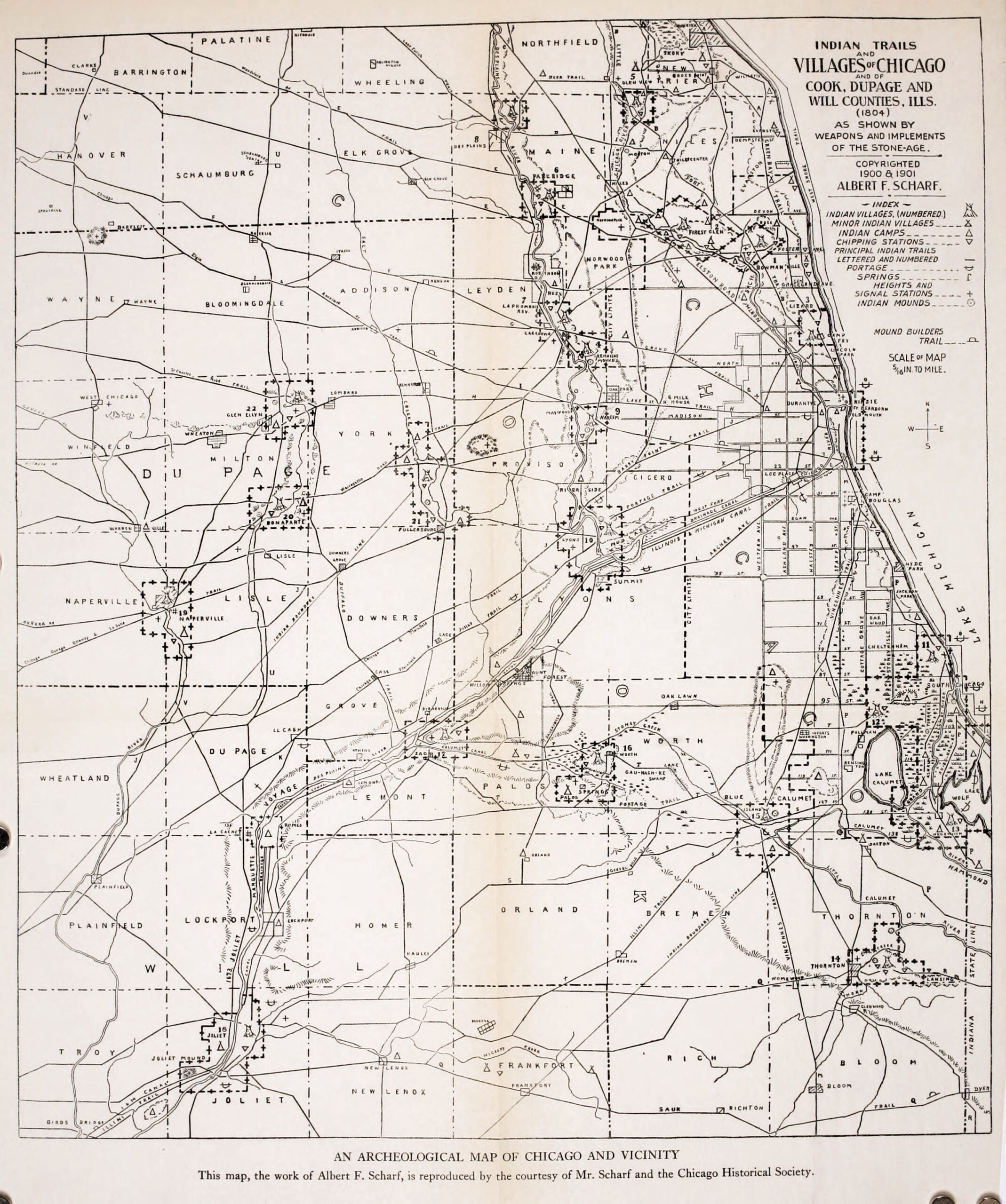
Scharf Map of Native American Trails and Villages
This map identifying Native American trails, villages, camps, and more in the Chicagoland area in 1804 is an excellent tool in helping us understand the late prehistory and early settlement of Blue Island and the surrounding area. There’s also accompanying text from a manuscript that Scharf wrote, containing more context and details than the map provides.
View a high-res version of the Scharf Map View the Scharf Manuscript